The Vegetation cameras
Simulations of Vegetation imagery


| The
Vegetation instrument The Vegetation cameras Simulations of Vegetation imagery
|
|
![]()
VEGETATION is an independent instrument which complements the main SPOT 4 payload, HRVIR (High Resolution Visible Infrared).
It is a complete and autonomous system made up of the following subsystems :
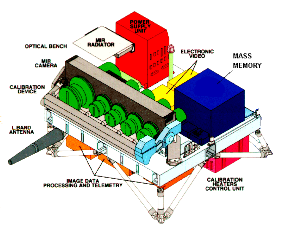
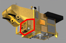
These subassemblies are integrated into a single package which is mounted at the base of the HRVIR instruments, with a volume of 1 x 1.1 x 0.7 metres and a mass of 152 kg.
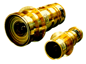
The instrument design uses 4 cameras, one for each spectral band, with each one covering the whole field of view.
These spectral bands are the same as those for the SPOT 4 HRVIR instruments.
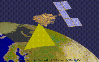
However, unlike the HRVIRs, the VEGETATION cameras cover a very wide field of view of 101° producing a swath width of 2 250 km. The nominal resolution for optimizing the instrument mission is defined by pixels of 1.165 x 1.165 km instead of the ten metres for the HRVIRs.
The Vegetation payload |
The instrument gathers light reflected by the Earth's surface and transforms it into discrete pixel values.
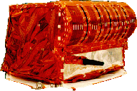
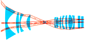 The radiation emitted by the area under observation passes
through a set of thirteen lenses. A wide- angle or spherical-parabolic lens at the
entrance of the instrument transforms the incoming light into constant illumation in the
focal plane, where the sensors are placed.
The radiation emitted by the area under observation passes
through a set of thirteen lenses. A wide- angle or spherical-parabolic lens at the
entrance of the instrument transforms the incoming light into constant illumation in the
focal plane, where the sensors are placed.
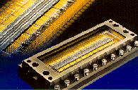 The
sensors for the visible channels are CCD silicon detectors very similar to those used in
digital cameras.
The
sensors for the visible channels are CCD silicon detectors very similar to those used in
digital cameras.
The shortwave infrared array consists of light-sensitive Gallium Arsenide, InGaAs
detectors
Each camera has :
Following analogue equalization, the four spectral channels are grouped together and multiplexed by an analogue-to-digital converter (ADC) using 10 bit encoding.
The signals are sent to the video electronics package for digitizing. They are then transmitted to the image processing device which sends them either to the onboard recorder or to the telemetry channel.
Telemetry can be sent at a ' global mode' level at 8 153 MHz known as the X-band, at a rate of 3.4 Megabits per second (Mbps). Over certain regions it can also be transmitted in L-band (at 1 704 MHz) at a rate of 0.51 Mbps.
![]()
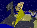 |
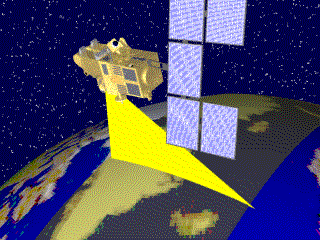
This animated illustration shows the swath covered by the Vegetation instrument. The scenes are acquired during the day over exposed land and viewing stops when the satellite crosses the oceans. In this example, the viewing begins over Greenland, then starts again over Newfoundland before covering South America. |
| If you are patient enough, click on the image
to get an enlarged animated picture. (be warned, this is a 1.17 Mbyte file) |
 |
![]()
page updated on the 00-06-06