What are the
stations for ?
CNES 2 GHz TT&C network,
Stations belonging to other countries.
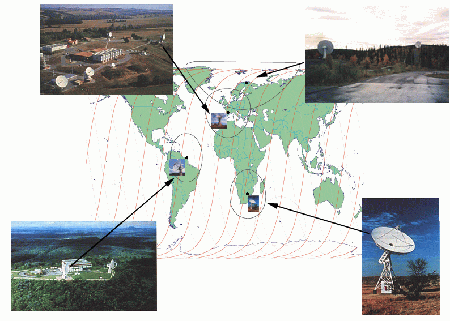
The only way to communicate with a satellite in orbit is by radio. A satellite tracking station provides the radio link between the satellite and its control centre. This is a two-way link (sending and receiving) at a frequency of 2 GHz .
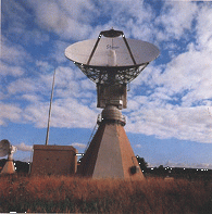
Physically, a satellite tracking station can be identified by its large dish-shaped antenna. The diameter of antennas varies from 9 to 26 metres. The rest of the equipment consists of transmitters and receivers.
Since SPOT 4 will be on a low circular orbit around the Earth ('orbit' describes the trajectory of the satellite around the Earth, 'low' an altitude of about 830 km), the laws of physics require that it complete its trip (around the Earth) in 101 minutes. Consequently the only way for a control centre to stay in contact with the satellite is for it to be linked to a network of ground stations providing global coverage.
These stations are vital for controlling the satellite during two phases of its life in orbit, final orbit acquisition and orbit control.
Final orbit acquisition begins when the satellite separates from the launcher, and is completed when the satellite reaches the desired final orbit. The orbit-control phase then begins. This consists of keeping the satellite on its nominal orbit. Orbit control involves correcting the orbit for perturbations (due to attraction by the Earth or the Sun, solar radiation pressure, etc.) and maintaining the satellite subsystems operational.
There are different tracking station requirements for each of these two phases. The orbit acquisition phase is the most difficult and requires greater coverage (and hence use of more stations) than the orbit control phase. Indeed, during the final orbit acquisition phase, the satellite and its subsystems will be activated and gradually placed (through successive impulses of its thrusters) on its nominal orbit.
The operations control centre is in Toulouse. Due to its geographical location it cannot "see" the satellite often enough to control it adequately. CNES has thus set up the 2 GHz TT&C network with different sites around the world. Routine operation uses the following stations:
Aussaguel |
Kiruna
(in Sweden) |
Kourou in French Guiana |
Hartebeesthoek (South Africa) |
CNES also has use of the Kerguelen station (on the Kerguelen islands in the southern Indian Ocean, which are part of France's southern and Antarctic territory), but does not use it much for the SPOT system.
This range of stations is necessary due to the "fleeting " Telemetry/Command (TM/TC) links which only last 10 to 15 minutes per pass within range of a station, which occurs about fifteen times a day if all stations are being used.
In addition to these TM/TC services, the stations measure satellite range and velocities relative to the stations (ranging) as well as angular measurements. These measurements are then used as input for precision orbit determination. This means that the satellites can be tracked without losing them, and that the geographical coordinates of the imagery can be accurately determined.
 Each ground
station consists of:
Each ground
station consists of:
During launch and final orbit acquisition phases, stations belonging to other national agencies are used:
NASA
- Wallops (on the east coast of the United States),
- Poker Flat (in Alaska).
NASDA
- Okinawa
(in Japan),
- Katsuura (in
Japan),
CCRS
- Prince Albert (in Canada).
![]()
page updated on the 00-06-06