|
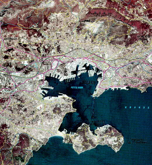
Extract of the satellite image map, Toulon toposheet, made from SPOT images taken on 14 July and 18 August 1993 with enhancements from the IGN's Carto« cartographic data base. Intial scale before reduction = 1 : 50 000.
Under the registered trademarks "SPOTView« BD Carto«", the Institut Gķographique National (IGN) and Spot Image produce satellite image maps which are available in analogue (film, paper) and digital forms (computer files).
![]()
page updated on the 06 June 2000